Location: On southerly end of Avery Rock, Machias Bay, Maine
Station Established: 1875
First Lit: October 1875
Operational: No
Automated: 1926
Deactivated: Destroyed by a storm in 1946
Structure Details
- Foundation Material: Not specified
- Construction Material: Brick and wood
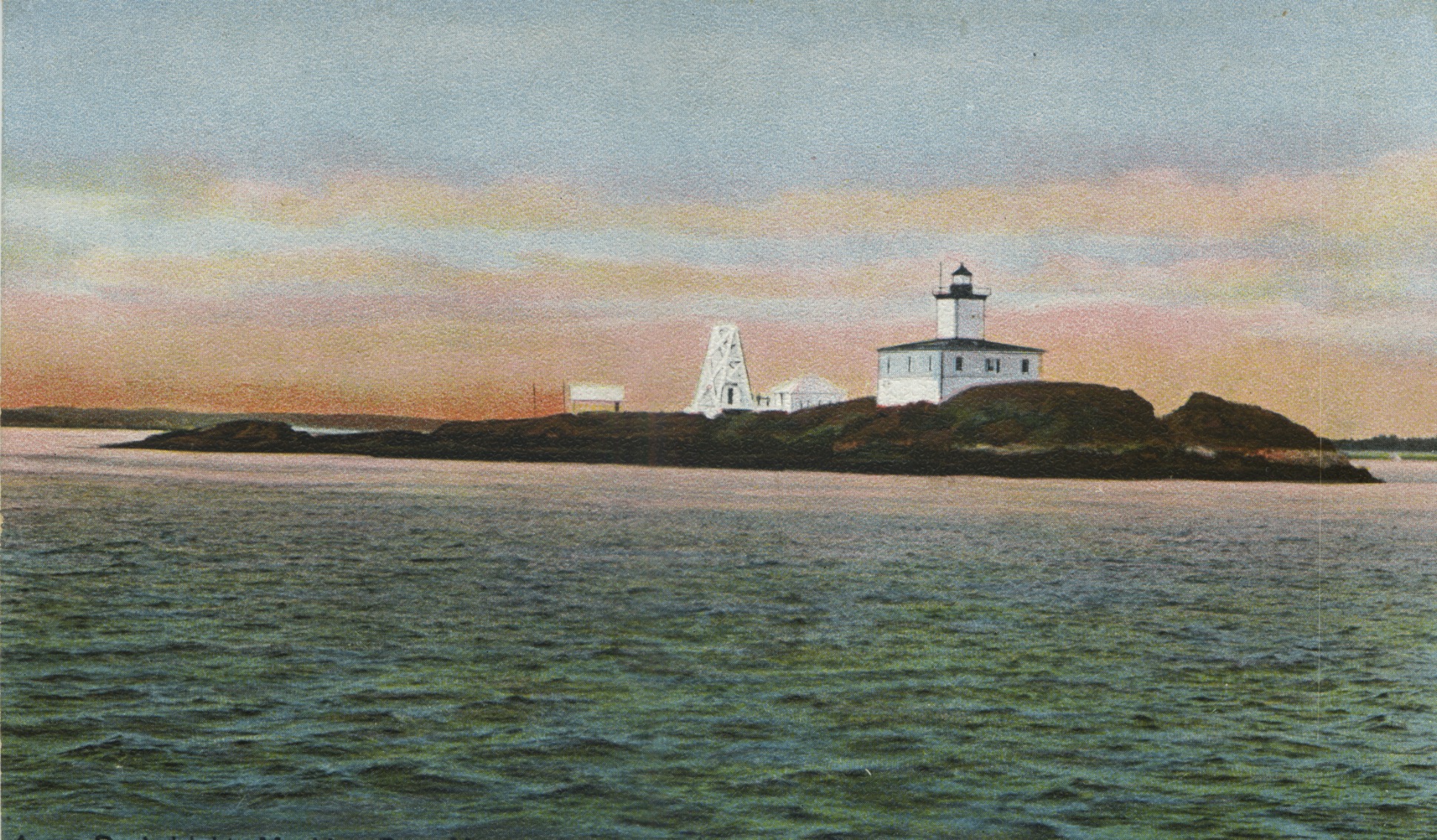
- Tower Shape: White square tower
- Markings: White square tower rising from a square dwelling
- Relationship to Other Structures: Attached
Optics & Illumination
- Original Lens: Not specified
- Tower Height: 34 feet
- Range: 13 miles
- Original Optic: Fourth Order Fresnel lens
- Present Optic: A buoy in the water 100 feet from the site of the lighthouse
- Characteristics: White flash every 6 seconds (In 1931, it was a fixed red light)
Expanded History of Avery Rock Lighthouse
- First Keeper: Warren A. Murch
- Current Use: No longer exists (Destroyed by a storm in 1946)
- Fog Signal: Fog Bell (1931) - One stroke every 10 seconds
Avery Rock Light was established in 1875 after President Ulysses S. Grant authorized its construction in 1874. The lighthouse was built on a barren rock at the southern end of Machias Bay, Maine, approximately three miles from the mainland. Due to its exposed location, the lighthouse was designed with 18-inch-thick walls and four-inch-thick shutters to withstand the harsh coastal weather.
Structural Features & Upgrades
- Originally featured a Fifth Order Fresnel Lens, emitting a white flash every six seconds.
- In 1902, the light was upgraded to a fixed red light.
- The station also had a fog bell, which struck once every 10 seconds to aid navigation in poor visibility.
Destruction & Replacement
Despite its reinforced structure, Avery Rock Lighthouse faced severe weather conditions throughout its existence. In 1946, a powerful storm demolished the lighthouse, leaving only remnants of its foundation. Following its destruction, a buoy was placed in 50 feet of water, 100 yards from the original site, serving as a navigational aid.
Sources & Further Reading
- Lighthouse Friends - Historical details on Avery Rock Light.
- Internet Archive Postcard - A historical postcard of the lighthouse.
- Wikipedia - General information about its timeline and structure.
- U.S. Coast Guard Historian’s Office - Official records and documentation.